|
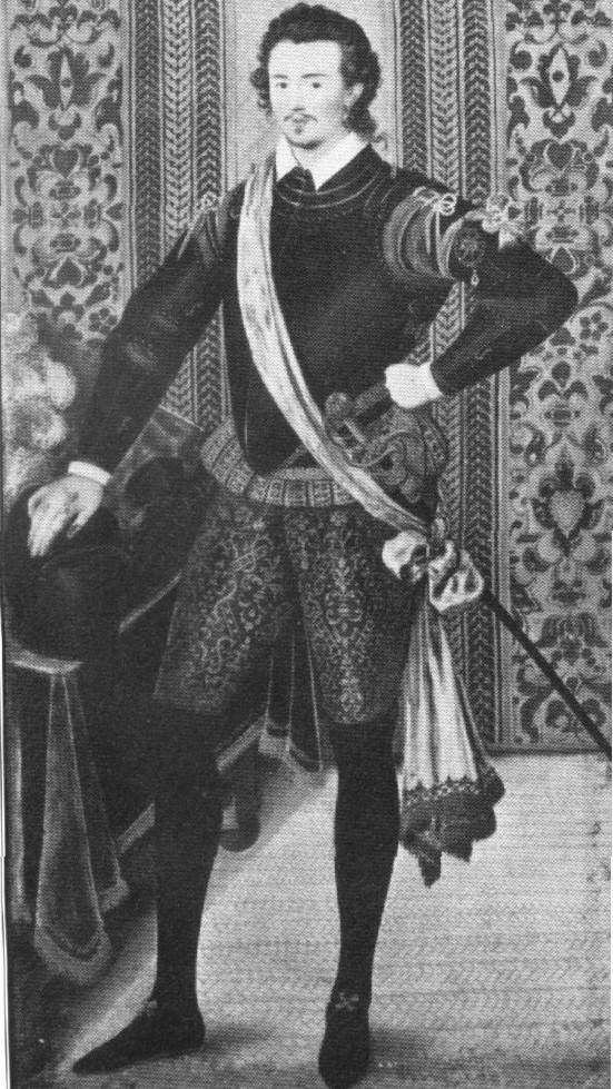
Sir Robert Dudley 1574-1649, A Renaissance Man .
Sir Robert Dudley, was the son of Lord Robert Dudley, Earl of Leicester, a favorite of Queen Elizabeth I. Legitimate or illegitimate, has been an argument that has been going on for years and it really doesn't matter, for all will agree he was Robert's biological son. Brilliant and ambitious, he became an extraordinarily skilled navigator, engineer, and chartmaker, and aspired to make a major voyage of discovery in the fashion of Sir Francis Drake. Dudley's life was noteworthy, and was, however, a bigamist, privateer, engineer, mathematician, architect and designer of warships and scientific instruments. In 1594-5 he commanded an expedition to the West Indies and the Guiana coast of South America. In 1596 he served as commander of a vessel in the attack on Cadiz for which he was knighted. He fell out of favor at the English court due to his philandering and ill-considered support of the Essex rebellion and in 1605, Dudley, a Roman Catholic, fled religious persecution in England and settled in Tuscany, Italy. After leaving England, he assumed the titles of Duke of Northumberland and Earl of Warwick, and entered the service of the Grand Duke of Tuscany. From 1606 until his death in 1649 he lived in Florence and was an influential member of the Court of the Medicis. under the patronage of the Grand Duke of Tuscany a member of the Medici family - for whom he undertook a series of projects including the draining of the swamps between Pisa and Livorno (Leghorn). |
|
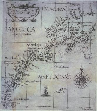
Chart of the East Coast of North America . Published in 1646, this was the first sea atlas by an Englishman (expatriate notwithstanding) and the first printed sea atlas with world-wide coverage; it is generally considered to be the most distinguished of its time.
The distinctive style of Dudley's charts, typical of Italian baroque art, is attributable to the elegant engraving of Antonio Francesco Lucini. It is believed that Lucini created this reduced version for a never-published "portable" edition of Dudley's sea atlas. This is one of two known examples, and the only copy in a public collection.
|
|
Sir Robert Dudley's Della arcano Del Mare
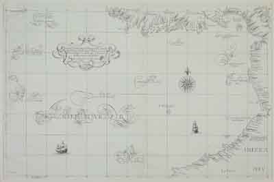
This is a photo of the rare and important chart from Sir Robert Dudley's Della arcano Del Mare covering the southern and western coasts of the Isthmus of Panama from Nicaragua south to the Columbian coast at Cape Francesco. To the westwards the Cocos Island is shown and "Las Gualapagus e. vicino del Equinozio" - an early reference to the Galapagos.
|
|
|

Need a Website? We can build you one!
|


