|
Sir Robert Dudley's Dell'Arcano del Mare "Secrets of the Sea" In describing maps, the words, first and unique are used very liberally as many antique maps have some special features. However in the case of the great sea atlas of Sir Robert Dudley there are no other words to describe the work. This was the first sea atlas to cover the entire world, the first to use Mercators projection and the first by an Englishman, albeit one working in Italy. The six-volume work covered navigation, shipbuilding and astronomy , with 130 maps in two volumes (nos. 2 and 6) . Unlike the vast majority of his contemporaries, Dudley's maps are all his own and were not copied from other mapmakers. They have an instantly recognizable style, closer to the pre-17th-century manuscript portolan charts than the richly decorated maps of Mercator, Hondius and Blaeu. Later map-makers chose not to copy Dudley's style and so it remains unique in the annals of cartography. The engraving by Antonio Francesco Lucini, who stated that he spent 12 years and used 5,000 pounds of copper to produce the plates, is of exceptional quality as is the calligraphy.
|
Carta Particolare Che Mosta Il Capo Buona Speranza. Very large sea chart of southwest Africa from Cape Fria to Cape of Good Hope, including Tristan da Cunha. Engraved by Antonio Lucini for Sir Robert Dudley's sea atlas 'Dell' Arcano del Mare', "the first English sea-atlas, the first sea-atlas of the whole World, and the first on Mercator's projection". Decorated with ships and swash lettering.
|
|
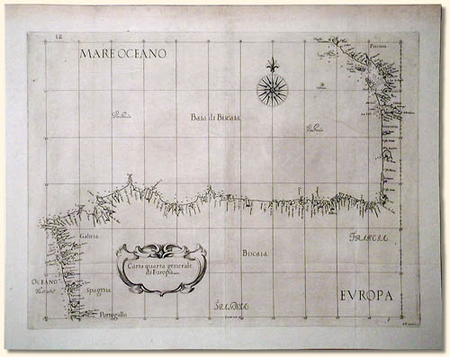
Carta Quarta Generale di Europa, 1646. This is one of the larger scale, generalized (Carta Generale) maps and shows the West coast of France, southward from La Rochelle, and the Northern coast of Spain. This is the least ornate of the styles adopted by Dudley with no adornment other than the cartouche and a compass rose and fairly plain calligraphy.
The next four maps represent the majority of the smaller scale, more specific (Carta Particolare) maps and include sailing ships, notes on prevailing winds and currents and more stylized calligraphy.
|
|
|
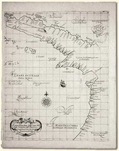
Carta Particolare della Costa Australe scoperta dalla Ollandesia, 1646. This, according to Tooley, is the first separately printed map of Australia and is therefore much sought after. It shows, in addition to the West side of the Cape York peninsula, much of the island of New Guinea. By labeling the Torres Strait Golfo Incognito Dudley leaves open the question of whether New Guinea is connected to the Southern continent.
|
|
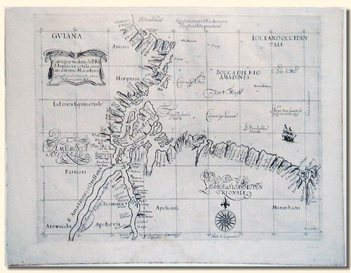
Carta Particolare della Rio d' Amazone con la costa sin al fiume Maranhan. 1646. Dudley's magnificent map shows the mouth of the Amazon River.
|
|
|
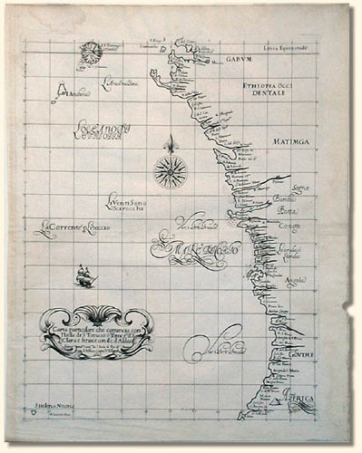
Carta particolare che comincia con l' Isola di S. Tomaso o Tome....Clara e finisce con Il c. d' Aldeas". This map of the shoreline of the African Congo includes an elegrant cartouche, and islands off the coastline.
|
|
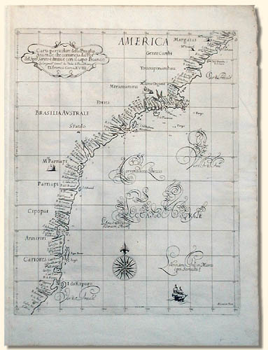
Carta particolare della Brasilia Australe che comincia dala Poro del Spirito Santo e finisce con il capo Bianco". A strip of the southern Brazil coastline. Included are Sao Paulo and the area later to become Rio de Janeiro. This includes some of the most peciliar representations of mountains near the coastline found on any Dudley map.
|
|
|
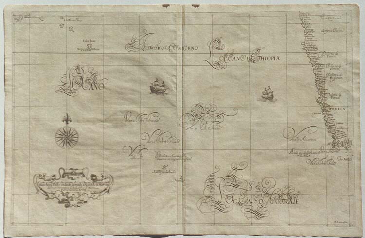
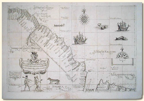
French Guiana, Guyana and a small portion of Brazil. The seventh map is one of only two in the atlas which have no title but instead dedications to the Grand Duke and, in this case, the Grand Duchess, of Tuscany, Dudley's patrons. This is another double page map and probably comes from the 1646 edition. These two maps are probably different because they are the only ones where Dudley was able to use his own observations as they cover the North East coast of South America, the area he visited in 1594. This map shows the coasts of French Guiana, Guyana and a small portion of Brazil. Considerably more elaborate than the others, this map includes soundings and numerous illustrations, namely: two ships, a canoe, two magnificent sea monsters, a (?) puma and two natives. It also has a legend stating that Monoa - more often known as El Dorado is only 12 days journey up-river from the coast !
|
|

Need a Website? We can build you one!
|